|
|
Trail of the Cedars, Glacier National Park, Montana
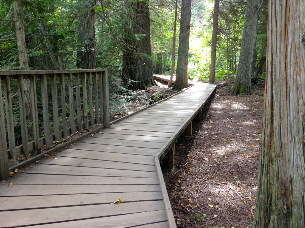
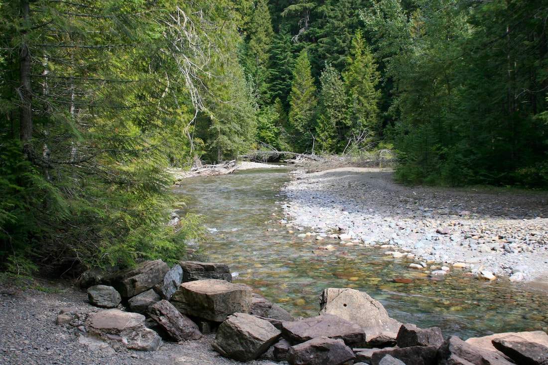
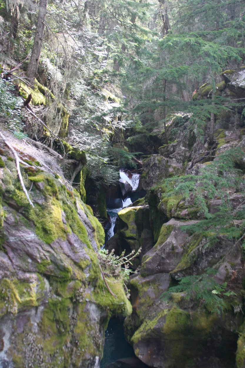
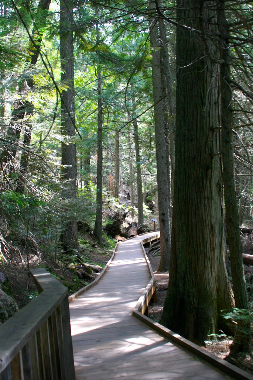
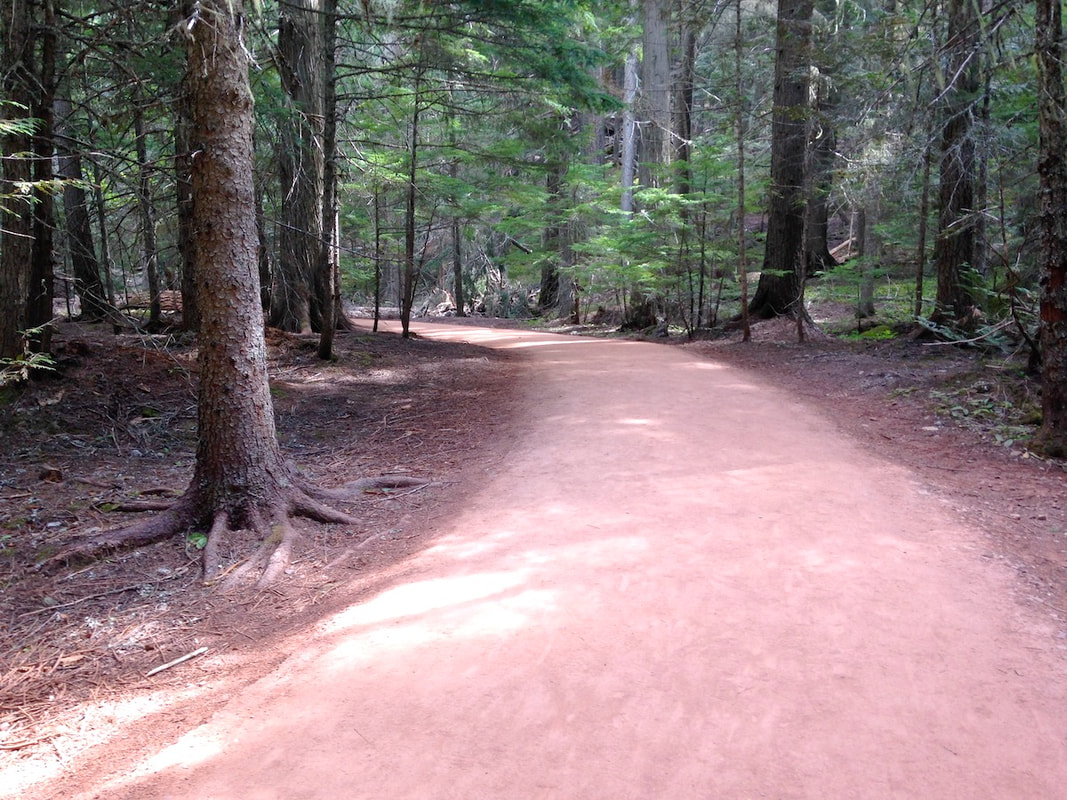
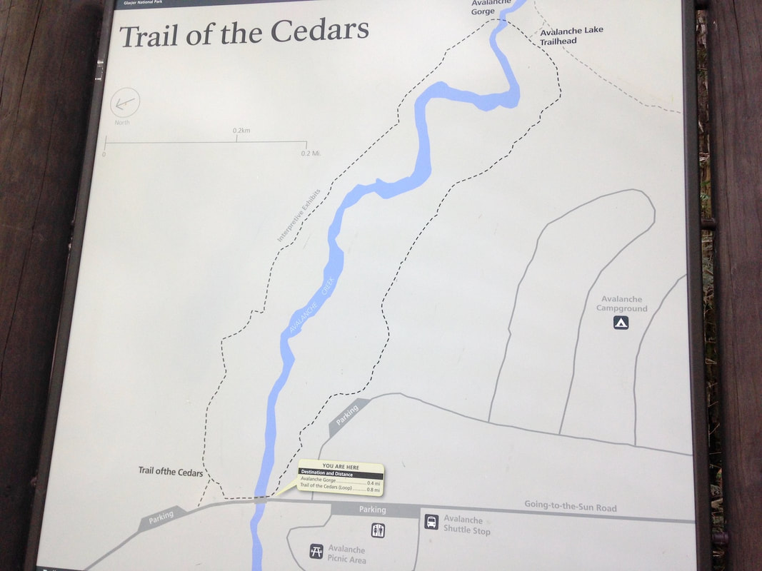
Length: 0.8 miles Width: Minimum width 36 inches, typical width > 60 inches Surface type: Boardwalk and stabilized crushed stone Typical grade: Boardwalk < 4%, Crushed stone 5% Maximum grade: 6% for boardwalk, 7% for crushed stone Typical cross slope: < 3% Maximum cross slope: 5.3% Obstacles: 36 inch wide bridge Use Fee required?: From May 28 to September 6, 2021, day-use access to the park between the West Entrance and St. Mary Entrance will require both a park entrance pass and a day-use entry reservation ticket with photo ID for Going-to-the-Sun Road. Accessible features: Avalanche Campground has one designated ”accessible” campsite. Accessible parking is available. flush toilets with grab bars. There are over 700 miles of hiking trails in Glacier National Park. Approximately 1.5 miles are described as “wheelchair accessible”. This trail is a great example of 0.8 miles of those trails and should be experienced. Trail of the Cedars is one of the most popular hikes in Glacier National Park. This is because it is located right on the Going-to-the-Sun Road, has an associated picnic and campground, and is a beautiful stroll through a western cedar and western hemlock forest of large trees. The 0.8 mile loop trail courses through the forest on part boardwalk and part stabilized crushed aggregate at generally low to moderate grades. The trail goes up one side of Avalanche Creek and down the other. The apex of the loop is a narrow foot-bridge cross Avalanche Creek which is in a narrow gorge there. The bridge, only 36 inches wide, is a choke point and becomes an obstacle because people, justifiably, tarry on the bridge for the view into the narrow gorge. Trail of the Cedars is a quick respite from the traffic of the main road through the park. Traffic noise disappears except for a few motorcycles. Parking, especially “accessible” spots, is limited and is available at spaces on the highway and along the road into the campground. Trail of the Cedars is located about five miles northeast of Lake McDonald on the Going-to-the-Sun Road. For day-use permits see: https://www.nps.gov/glac/planyourvisit/gtsrticketedentry.htm Las visitied May 2016 See the Fine Print |