HELP-PEOPLE-WITH-DISABILITIES-ENJOY-THE-OUTDOORS
  • Home
  • What does "accessible" mean?
  • Current Projects
  • Our mission
  • Contact
  • Directors
  • little-river-trail
  • oconaluftee-river-trail
  • sprague-lake-trail
  • glenn-kelly-path
  • lower-emerald-pools-trail
  • parus-trail-zion
  • historic-railroad-trail
  • anthem-east-accessible-trail
  • red-rock-canyon-overlook-accessible-trail
  • sandstone-quarry-accessible-trail-red-rock-canyon
  • island-forest-accessible-trail-great-basin
  • trail-description-waiver
  • sun-notch-trail-crater lake

Ongoing projects for creating more access to public parks

​The fastest way to add accessible facilities and trails to U.S. parks is to find features that are almost accessible (the low-hanging fruit) and then to work with the park managers to find ways and funds to upgrade them. 
Picture
Picture

Trails Access Project
​

We won! Trail Access Project teamed with Get Outdoors Nevada and won a federal grant totaling almost $25,000.  This grant, managed by Nevada Division of State Parks, began early in 2018. 
Value: $24,600

​Funded by: Recreational Trails Program Grant (2018-2021) from the Federal Highway Administration 
​
Status: Equipment purchased and delivered, trail assessment in process. We have now completed 19.6 miles of bike path assessments in Lake Mead National Recreational Area. March 28 and 29, 2019 we provided in-the-field Trail Assessment Training to employees of the U.S. Bureau of Land Management, the National Park Service, and the U.S. Fish and Wildlife Service. 

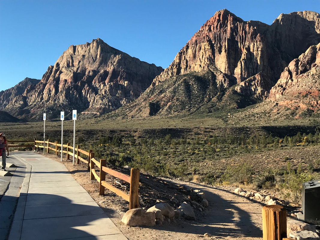
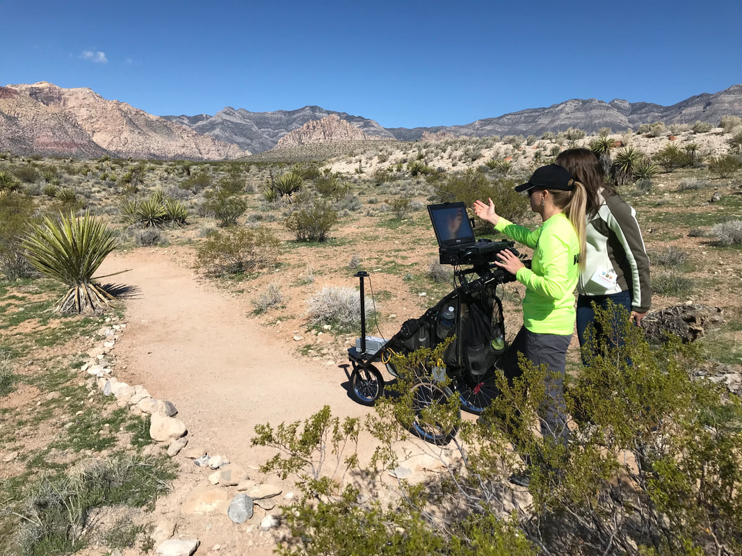
What we are doing:  Under the Trails Access Project, we purchased the High Efficiency Trail Assessment Process (HETAP) digital trail assessment cart, manufactured by Beneficial Designs, Inc., of Menden, Nevada.  We are assessing sixteen trails totaling 24.4 miles on federal lands in Southern Nevada, for their accessibility characteristics.  The trails are located at Red Rock Canyon and Sloan Canyon National Conservation Areas, Lake Mead National Recreation Area, and at the Desert National Wildlife Refuge.  We are providing to those parks trail dimensional data such as slope, cross slope, tread width, stability of surface, and any obstacles, etc., that will be posted on a trailhead sign at each trail. 
 
Managers from each of these federal agencies and an official “Friends” group wrote letters of support for our project:
 
National Park Service
U.S. Bureau of Land Management
U.S. Fish and Wildlife Service
Friends of Red Rock Canyon
 
Trail Access Project and Get Outdoors Nevada would like to thank the Nevada Division of State Parks for selecting our Trails Access Project as worthy of funding.

Picture
Picture

  • Home
  • What does "accessible" mean?
  • Current Projects
  • Our mission
  • Contact
  • Directors
  • little-river-trail
  • oconaluftee-river-trail
  • sprague-lake-trail
  • glenn-kelly-path
  • lower-emerald-pools-trail
  • parus-trail-zion
  • historic-railroad-trail
  • anthem-east-accessible-trail
  • red-rock-canyon-overlook-accessible-trail
  • sandstone-quarry-accessible-trail-red-rock-canyon
  • island-forest-accessible-trail-great-basin
  • trail-description-waiver
  • sun-notch-trail-crater lake