|
|
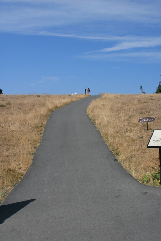
Cirque Rim and Big Meadow trails, Hurricane Ridge, Olympic National Park, Washington - Warning: very steep slopes!
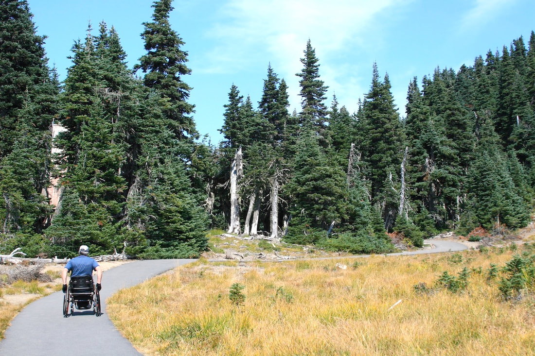
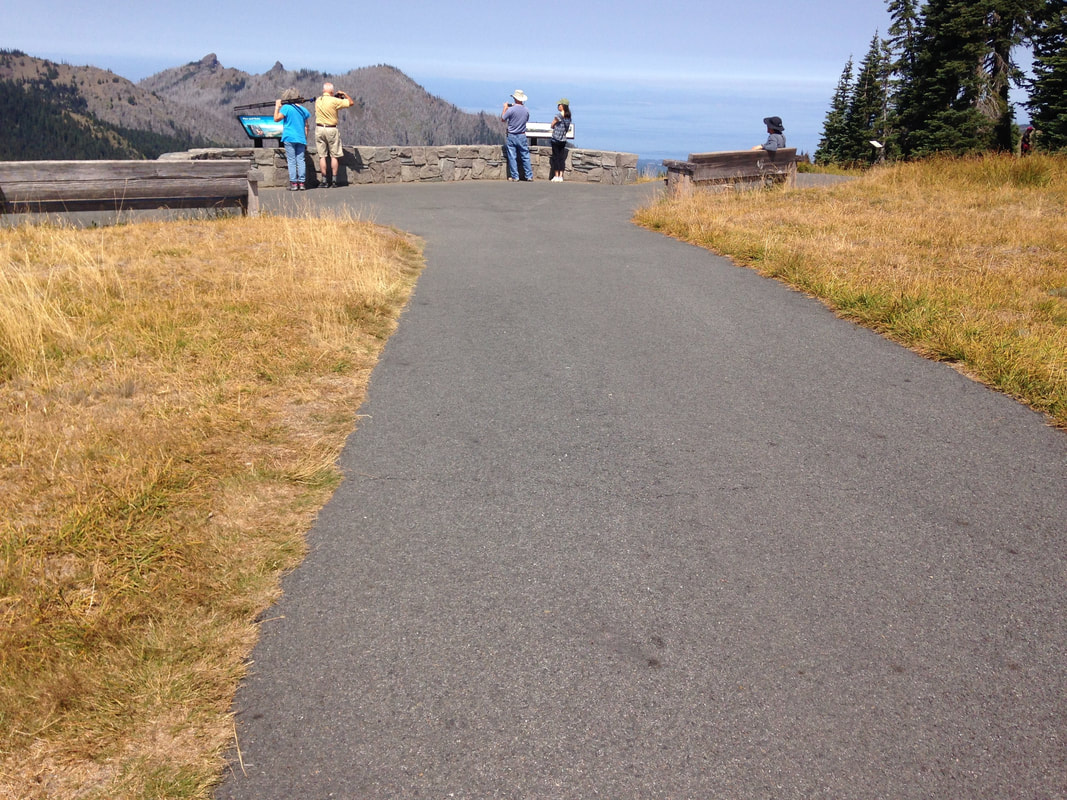
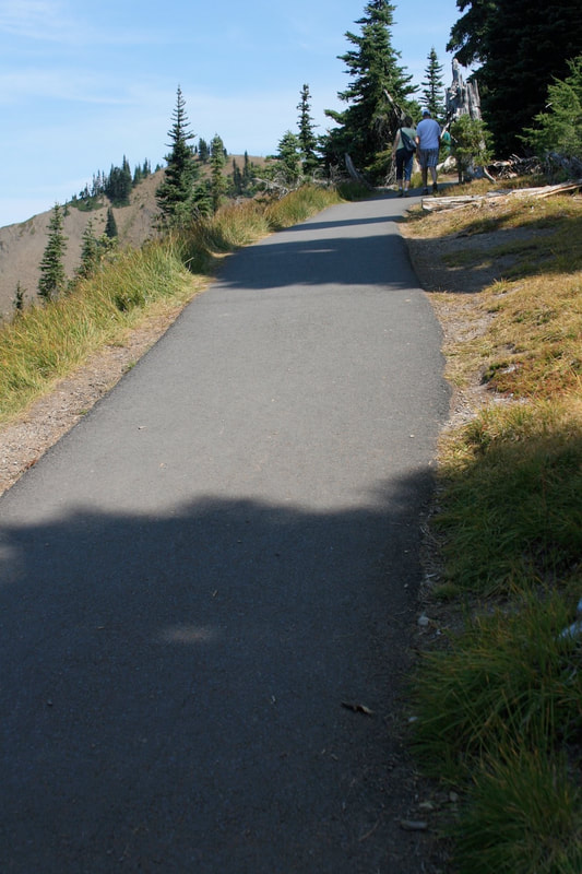
Length 0.6 mi. Type of trail Intersecting loops Trail width Cirque Rim 4 ft., Big Meadow 8 ft. Surface Asphalt Elevation gain ~50 ft. Maximum grade 21% near overlook Typical grade 12% Maximum cross slope 4% Typical cross slope 1% Obstacles Steep grades Accessible Features Parking, restroom in visitor center Hurricane Ridge offers the iconic mountain views of Olympic National Park, near Port Angeles, Washington. Seventeen-mile-long Hurricane Ridge Road takes you from near sea level at Port Angeles to the Hurricane Ridge Visitor Center and trails a mile above sea level. This is a mountain road so leave your trailers behind. Hurricane Ridge Road is open only in summer and access may be restricted when parking is full. When this writer rolled up to the visitor center information desk using a manual wheelchair and asked “Where can I hike?”, he was told “Here is a map of our accessible trails”. The map was of the Cirque Rim and the Big Meadow trails, intersecting paved paths across the parking lot from the visitor center. These trails, described here together, provide a gorgeous alpine meadow and forest experience and panoramic views to the north of Port Angeles, the Strait of Juan De Fuca, and Vancouver Island, on a lucky day. Views to the south are of the Olympic Mountains. The National Park website describes both of these trails as “An easy paved trail” and “wheelchair accessible with assistance”. Neither of these trails should be considered “accessible” because of very steep and dangerous grades. Federal accessibility guidelines have no category for “accessible with assistance”, very subjective words. The main access to the trails is from the middle of the parking lot. There is one handicap parking space there at the trailhead. Leaving the parking lot on the trail you immediately climb a grade of 14% for 190 feet. That is not "easy" for most adaptive hikers. Immediately east of the viewpoint on the Cirque Rim trail we measured a grade of 21% on a curve. Many adaptive hikers, either ambulatory or those using adaptive equipment, would have difficulty with that grade either going up or skidding down. If you fail to make the curve at the bottom because you can’t control your speed on that grade, you are going down the bank. Neither of these trails should be described as “easy” when discussing acessiblilty. The nearby Hurricane Ridge trail has recently been rebuilt and paved with asphalt. The first 4/10 mi. should meet federal recreational tail accessibility guidelines. See the Fine Print |