|
|
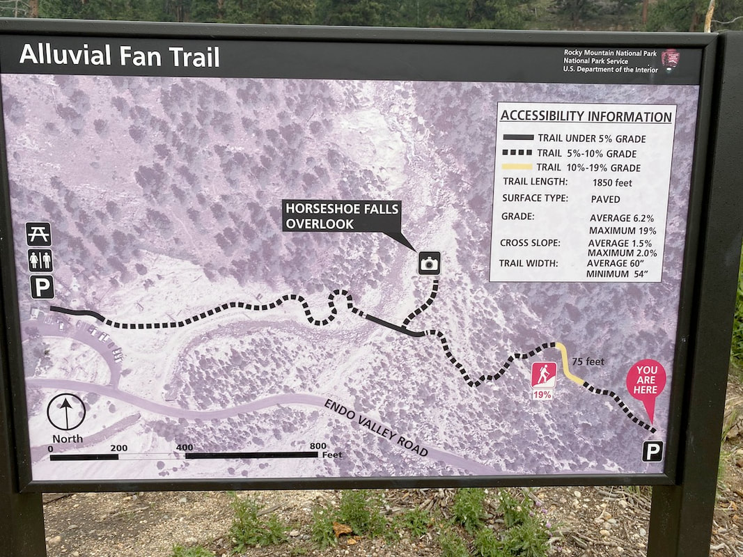
West Alluvial Fan Trail, Rocky Mountain National Park, Colorado
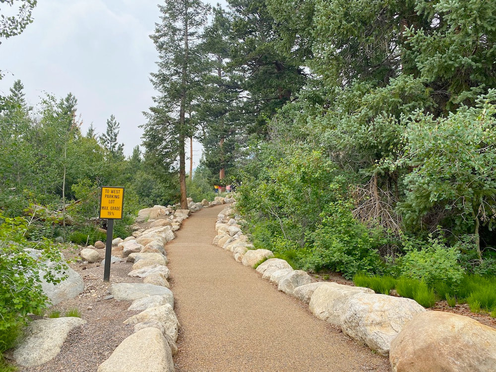
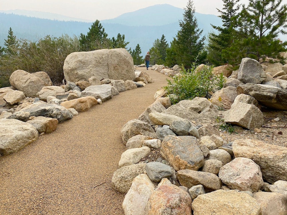
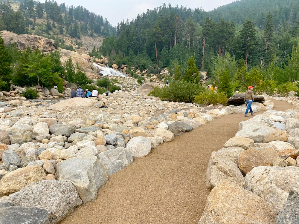
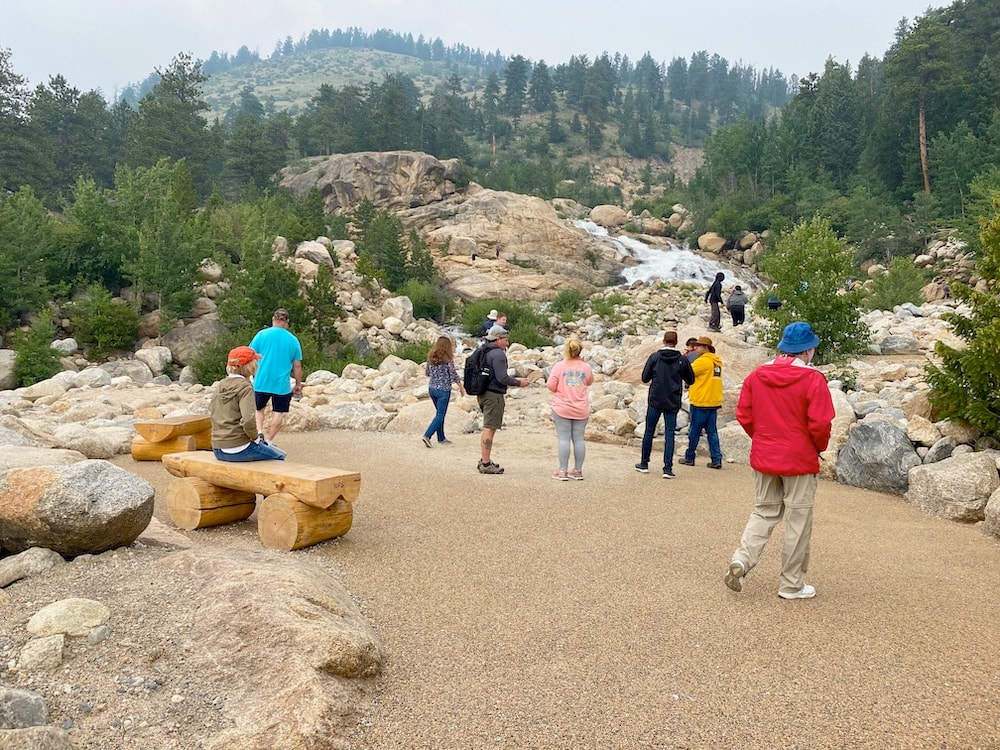
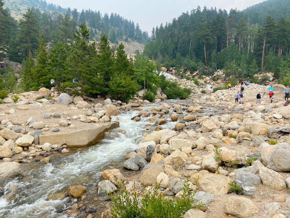
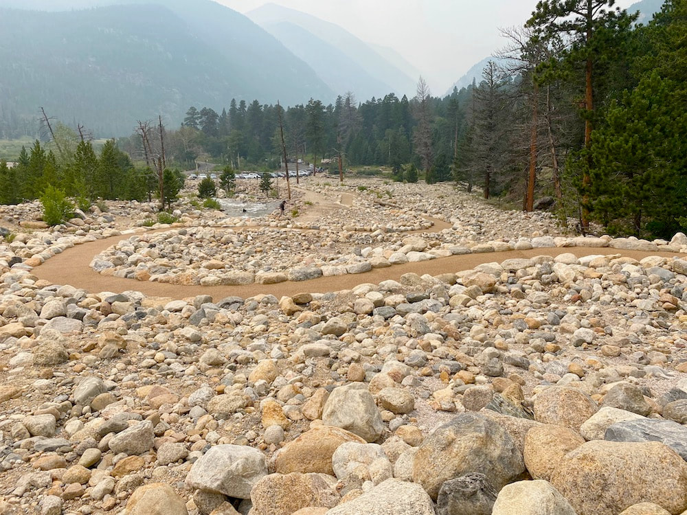
Length: 0.3 mi. to summit view and back Width: 60 in. minimum 54 in. Surface type: Paved with permeable gravel texture surface Typical grade: 4-10 % Maximum grade: 10 % Typical cross slope: 1.5 % Maximum cross slope: 2 % Obstacles: None Use Fee required?: Park entrance fee plus timed entry permit from 6am to 3pm Accessible features: Parking, restroom, picnic area, Horseshoe Falls viewing area The West Alluvial Fan Trail will be one recommended as “accessible” for the east side of Rocky Mountain National Park; however, it is crowded in peak season. The alluvial Fan Trail is an interesting, short, paved trail that connects two parking lots, the east and west lots, with a midway short side trail to view rapids in the Roaring River tumbling from above. Park in the west parking lot because only the west end of the trail can be considered as the more accessible. The east side, while paved, gets up to 19% grade and is unsafe for individuals with adaptive hiking needs. There are warning signs about the grade. The West Alluvial Fan Trail gets up to about 10% grade with low cross slope. The surface is attractive jointless pebble-textured pavement called FilterPave, a firm but porous material that water can pass through. It is bordered with native stones. Larger boulders are placed along the trail sides as resting seats. The parking lot at the west end of the trails has two accessible parking spots, toilets with handrails, and a nearby picnic area. The picnic area has gravel paths to tables. An alluvial fan is a delta-shaped deposit of sediment on land deposited by large stream flow usually during flash flooding. This alluvial fan consists of sand, gravel and boulders washed here rapidly in 1982 when an earthen dam broke upstream. To get there, drive 2.0 miles west on Hwy 34 (Trail Ridge Road) from the Fall River Park entrance station. Turn north from Hwy 34 to Endovalley Road and drive 0.75 miles to the West Alluvial Trail parking lot on the right. You will go past the East Alluvial Trail parking lot to get to the west lot. August 13, 2021 |